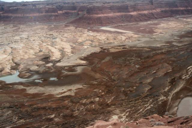
The eastern end of Lake Powell, January 3, 2005, approximately 180 miles from Glenn Canyon Dam.
Unless the dam is removed--which is unlikely in the near future--the reservoir waters will return again. The Colorado River is the water in the center left of this photo. In the upper center, you can see the Colorado River bridge. (Without double clicking on this image you likely will not be able to see the bridge.)
River runners coming out of Cataract Canyon after week-long river trips know this bridge as their first encounter with civilization--excluding the upper reaches of the reservoir--after days in one of the Colorado River's other Grand Canyons. From roughly the mid to late 1970s until around 2002/3 the reservoir went miles above where the bridge is located in this image. Before the recent drought--which has at the very least eased up this winter--the area photographed here was an artificial, beautiful, invasive, horrible, man-made inland sea. Which is it?
Lake Powell is both a jewel in the desert and an assault on the landscape. To those of us who love wild areas, riparian eco-systems, and free-flowing rivers, the lake is an assault on morality--man run amok with his technological prowess. Because we can build a dam we do--even though Lake Powell is hard to justify based on any traditional dam building rationales. It only takes water out of the Colorado River system through massive amounts of evaporation. No water is used from the lake for agrigculture or municipal uses. The Colorado River water that is used by the fast growing cities of the American West is sucked out much further downriver (Arizona's Colorado River water is removed from the river below Hoover Dam at Lake Havasu). **See note below on hydro-electricity.
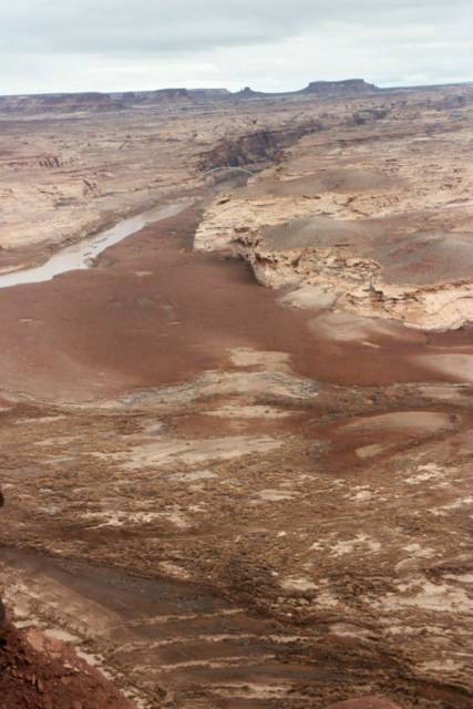
For millions of vacationers with their houseboats and ski-boats, Lake Powell is a man-made wonder. In a desert land of slickrock and redrock formations, the lake became a recreational paradise for the motorized boat crowds over the past few decades. People can enjoy the desert, but their enjoyment came at the cost of drowning a stunning canyon, the former Glen Canyon which remains under water today (immediately down river of this image and the image below).
The "lake" area is easily distinguished here as the entire foreground narrowing into the Colorado River and the lower end of Cataract Canyon at the top of the photo--or simply the darker parts of the photo. For any of us who spent time in this area in the 1980s and 1990s through about 2003, this photo is breathtaking for what is not there: the slack water of Lake Powell. Of course the temporary disappearance of the reservoir has allowed for the reappearance of the river that has traveled through this land for millions of years, the Colorado.
**Note: Glenn Canyon Dam generates 1.3 million megawatthours of electrity per year, when operating at full capacity. Almost all of this electricity is used in Arizona where it represents about 2% of the annual electric needs of the state (1999 electric consumption in Arizona: 58.1 million megawatthours). Source: Arizona state profile, U.S. Department of Energy, for 1999.